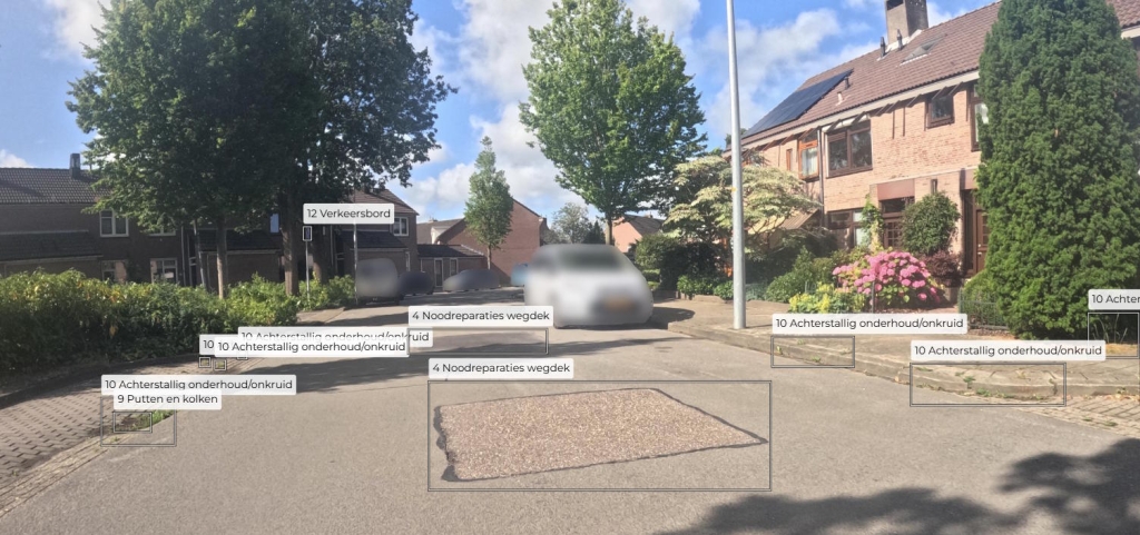
Local governments need to know the quality of the public space such as the state of the roads and maintenance of parks. Currently, they are often dependent on manual inspection by city staff or notifications from citizens. The resources for this manual inspection are limited and costly and governments can only do as much as they can. This is where the Airvision platform comes in.
With our platform, images from the municipality can be automatically inspected and detect any relevant objects. It does not matter what the source is of the images; they could be street-level, drone, or aerial images. In this way, damage to the road can be recognized, stray garbage can be localized, and places to remove weed are found. Furthermore, these results can be shown on a map which gives a clear overview where the local government should focus its limited resources to have the highest impact!
Please Contact us if you would like to know more!